Before any construction or development, a crucial step lies in the foundation for safe, cost-effective work: the topographic survey. More than just lines and points, this survey is an in-depth map revealing natural and artificial features of a parcel of land—capturing contours, elevations, trees, bodies of water, buildings, fences, and even underground utilities. Professionals rely on this detailed snapshot to understand drainage, manage earthwork, and avoid future surprises, whether planning a commercial project, a suburban neighborhood, or a public park. Without it, essential site characteristics could easily be overlooked, sending budgets off the rails and schedules into chaos.
Accurate topographic information doesn’t show the Earth’s ups and downs. It highlights problem zones—like flood-prone areas or locations with unstable soil—and pinpoints spots where careful engineering will matter most. A topographic survey is the backbone of design, ensuring all downstream decisions are based on data grounded in reality, not assumptions. This step is essential for anyone who wants to proactively manage risk and streamline their path from empty lot to finished project.
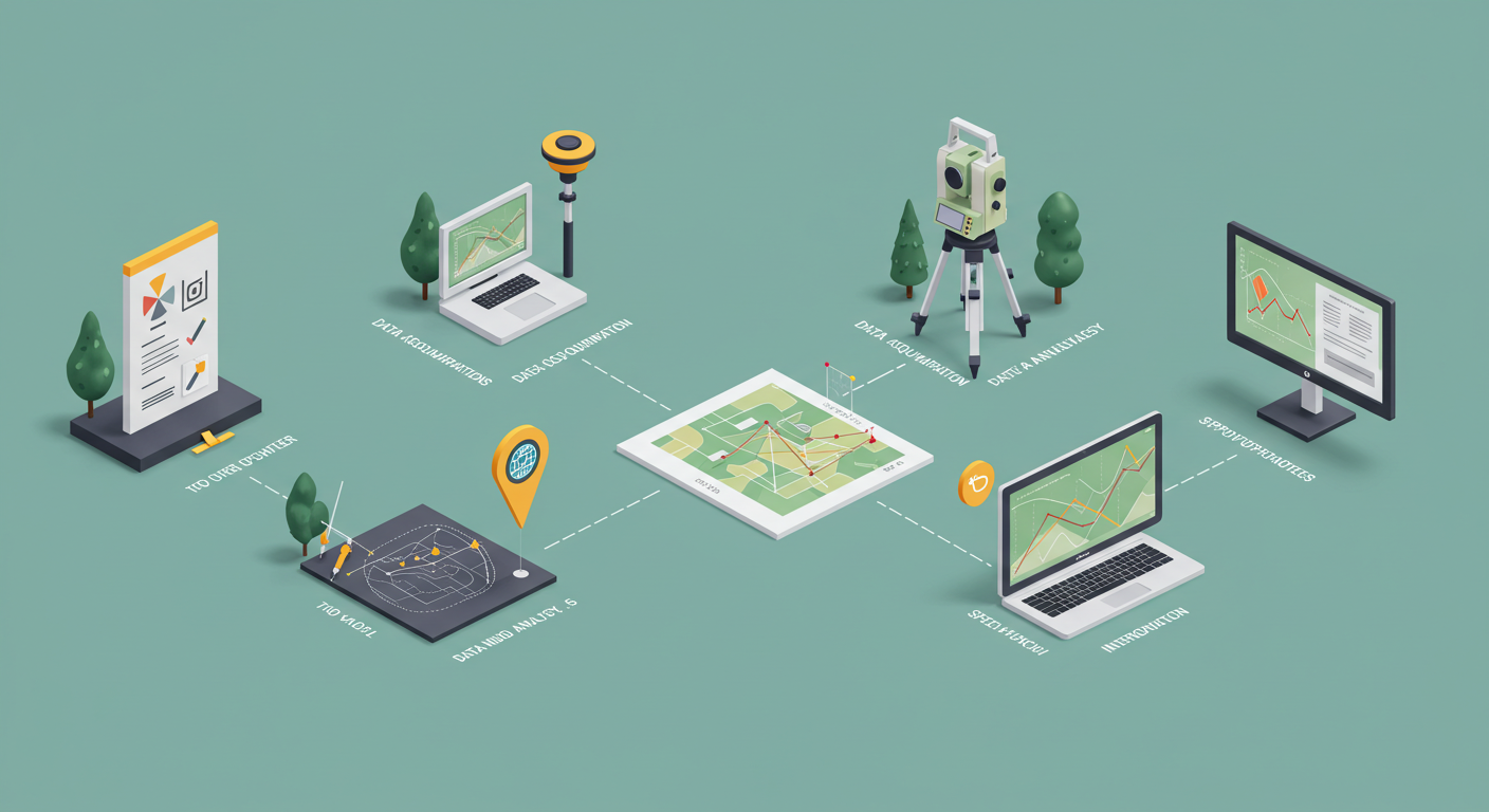
Planning for Survey Success
The groundwork for success is established well before field crews arrive with their instruments. It starts with a thorough site review and clear goal setting. Recognizing which property features to document ensures efficiency and avoids costly oversights. For instance, a survey for a new road will prioritize contours, water pathways, and existing transportation routes. In contrast, a survey for a future subdivision might focus on utility access and precise lot dimensions. Engaging all stakeholders from the outset helps reveal critical information that could be missed. Open conversations with landowners, civil engineers, and property managers can unveil existing plans, provide historical context, and set expectations for survey deliverables.
- Decide exactly what information you need: terrain, boundaries, easements, vegetation, or surface infrastructure.
- Study prior surveys or government maps for background and look for seasonal factors—dense summer foliage or winter snow may hide important features or distort readings.
- Access issues such as locked gates, hazardous terrain, or wildlife should be identified to avoid delays or safety risks.
Skipping these planning steps often leads to project delays, unplanned costs, or incomplete data. By investing time upfront, surveyors can catch potential headaches before they happen and ensure seamless site visits.
Essential Tools and Technologies
Advances in technology are revolutionizing how surveys are conducted and how data is managed. While many still picture surveyors peering through tripods and jotting in notebooks, today’s kit stations include high-precision GNSS receivers and advanced 3D laser scanners mounted on drones. Uncrewed aerial vehicles can cover vast and rugged terrain that would take hours (or days) to traverse by foot, and aerial imagery quickly yields highly detailed point clouds.
Modern software seamlessly integrates massive datasets—often captured by multiple tools—into coherent, multi-layer digital models. Geographic Information Systems (GIS) help planners and engineers overlay the topographic survey data with city infrastructure, land usage, or flood zones. The US topographic mapping service provides insight into the industry shift towards digital, accessible, and authoritative mapping layers used by surveyors, governments, and the public. With the right technology, surveyors work faster and provide more detailed information.
These tools can have a learning curve, especially as cloud-based analysis and machine learning increasingly factor into data interpretation. Professionals who stay ahead by regularly updating their tech skills are more nimble and in demand.
Field Best Practices
No matter how advanced the technology, robust field protocols remain the backbone of quality surveying. The day often begins with equipment checks and calibration—a small oversight here can ripple into significant discrepancies later. Staking out permanent control points or using known benchmarks helps provide a reliable reference for the entire survey area.
- Always set up instruments on stable, level surfaces and double-check calibrations to ensure trustworthy readings.
- Redundant measurements and cross-checking with alternative methods (such as comparing GNSS and traditional total stations) add an essential layer of confirmation, which is especially valuable in uneven or high-interference areas.
- Detailed field notes—including weather conditions, access challenges, or sightline obstructions—give much-needed context to raw data, enabling teams to resolve anomalies after leaving the site.
- Backing up digital files on-site, ideally in real time, guards against data loss from hardware glitches or human mishaps.
Effective communication is also a practical best practice. Not only does it help coordinate with team members, but informing stakeholders of progress or unexpected obstacles can turn a potential roadblock into an opportunity for proactive solutions.
Avoiding Common Surveying Errors
Accurate surveying is as much about avoiding pitfalls as it is about capturing the correct data. Even minor missteps—like an improperly leveled tripod or a rushed field scan—can translate into thousands of dollars in rework once construction has started. Weather is an ever-present variable; heavy wind, rain, or fog can degrade measurements or hide key site features. Staying vigilant and prepared in different weather conditions often differentiates between trustworthy results and costly redos.
- Level and calibrate equipment before every measurement session, and validate calibration regularly throughout the day.
- Duplicate crucial measurements (especially in problematic areas) to help flag inconsistencies before leaving the site.
- Look for hidden features or changes in the landscape that may not be visible from aerial imagery alone, such as new construction, temporary obstacles, or previously undetected water channels.
- Compare current findings with data from historical surveys to spot trends or reveal missing features that could throw off project designs.
Surveyors who consistently apply these quality-control habits save their clients time, money, and frustration, delivering reliable foundations for project planning.
Applications of Topographic Data
The reach of topographic surveys extends far beyond building construction. Local governments use this valuable data to manage zoning, assess flood risks, and guide disaster preparedness plans. Conservationists rely on up-to-date surveys to monitor wetland boundaries and track habitat changes. Mining companies, pipeline engineers, and transportation agencies use detailed elevation and surface data to select routes and minimize environmental disruption.
In practical terms, topographic mapping leads to safer, more innovative, and more cost-effective developments. For example, construction firms prevent expensive surprises by overlaying survey maps with underground utility records, protecting both workers’ safety and infrastructure integrity. Similarly, city planners use contour data to design roadways and retention systems that manage stormwater runoff, supporting sustainable and resilient communities. There’s a prevailing consensus that up-to-date, precise land surveys are fundamental for anyone wanting to protect investments and manage risk over the long haul.
Regulations, Permits, and Ethics
Understanding and following the legal landscape is mandatory in the field of surveying. Most regions require survey work that impacts property boundaries—such as lot splits, rights-of-way, or easement documentation—to be carried out (and often stamped) by a licensed surveyor. Drones bring a new layer of permitting, particularly near airports or environmentally sensitive regions, and regulatory requirements can shift as laws evolve.
Transparency and ethical conduct are equally important. Survey professionals must respect privacy by only collecting data authorized by clients, and they should honestly report all results, favorable or otherwise. Ongoing candor with landowners, builders, and agencies is a defining mark of professionalism, builds trust, and protects the industry’s integrity.
Future Innovations in Surveying
The survey profession is rapidly embracing emerging innovations. Automation and artificial intelligence are now processing vast volumes of point cloud data in hours, not days. Drones and remote sensing equipment allow surveyors to gather highly accurate topographic data while minimizing the need for intrusive site work, helping safeguard delicate habitats and surveyors. Digital collaboration tools also enable teams to work together across continents, creating opportunities and insights that wouldn’t be possible with paper-based workflows alone.
The National Geographic Guide to Mapping delves into creative and sustainable mapping solutions, underscoring the current shift toward open data sharing. This openness makes survey data more accessible, fueling smarter, more inclusive decisions at every industry and government level. Adaptive surveyors will continue leading the way, harnessing traditional skills and future-focused tech for more innovative, safer, and sustainable land management.